Farun GPS Navigator

Offline navigation for the land & sea.

Rugged edge hardware with local maps, route calculation, elevation, GNSS positioning and marine mode for teams that operate beyond reliable connectivity.

0

Cloud dependency

LIGHT

Enclosure

2

Land + sea modes
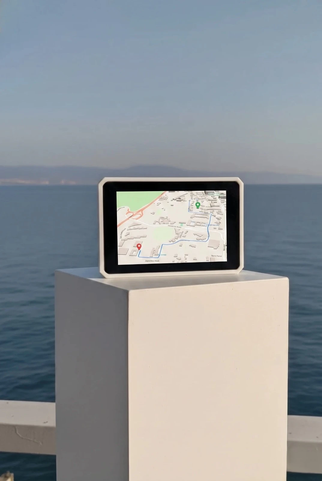
Farun GPS Navigator hardware

Edge engine active

Satellite lock acquired

Why It Exists

Cloud maps are not enough for serious field operations.

The Problem

Most navigation stacks assume constant connectivity. That breaks for expeditions, rural fleets, marine routes, emergency work, remote farms, and cross-border logistics.

The Farun Approach

Put the map engine, route graph, spatial data and GNSS inside the device so navigation continues when networks do not.

Core Capabilities

The entire navigation stack, in one box.

Farun is not just a GPS screen. It is a local spatial engine that can render, route, search, and expose data to your own systems.

Offline Vector Maps

Roads, terrain, water, POIs, and land-use layers stored locally for instant rendering without cell signal.

On-Device Routing

Calculate routes, reroute in the field, and keep navigation usable when cloud map services disappear.

Precision GNSS

Dedicated satellite positioning keeps location reliable beyond mobile coverage and urban network assumptions.

Marine Chart Mode

Switch from road and trail workflows to nautical layers, waypoint planning, and helm-ready operation.

Offline-First Storage

All maps, routes, elevation, and chart data stored directly on the device. Nothing is fetched from the cloud during operation.

Privacy-First Operation

Location workflows can remain on-device or inside your own infrastructure instead of defaulting to third-party clouds.

Use Modes

Move from road to water without changing platforms.

Overland navigation mode

Overland

Overland navigation

Built for remote vehicle travel, expedition convoys, rural logistics, and field teams that need road, trail, terrain, and POI context offline.

Marine navigation mode

Marine

Marine navigation

Use the same hardware platform at the helm with water boundaries, coastal context, nautical route planning, and GNSS-first positioning.

Marine Mode

A chart plotter built into the same offline navigation computer.

Farun is one hybrid device for road, field, coastal, and water workflows. Marine mode adds local nautical layers, waypoint routing, and GNSS-first navigation without a separate product.

Nautical Chart Tiles

Offline vector chart layers for coastal context, water boundaries and shoreline awareness.

Waypoint Routing

Plan marine routes between open-water waypoints and keep the route available when offshore connectivity drops.

Helm-Ready Operation

Use the same 5V hardware platform for dashboard, field, and marine helm mounting.

Marine Workflow

Step 1

Load chart bundle

Select the relevant coastal or inland water region before departure.

Step 2

Plan waypoints

Set route points, inspect surrounding layers, and prepare alternate paths.

Step 3

Navigate offline

Use GNSS positioning and local chart data when cloud services are unavailable.

For Operators And Developers

Use it standalone, or connect it to your stack.

The GPS Navigator can be deployed as a self-contained field device or use our spatial APIs for fleet dashboards, embedded systems, and private operations software.

Spatial API Platform

Farun's location APIs are a separate cloud product for software teams with routing, maps, elevation, isochrones, and more. Not required to use the GPS Navigator.

Explore the API platform

Specs Preview

Power

5V Continuous

Positioning

Precision GNSS

Storage

Local High Endurance Storage

Operation

Offline Maps, Routing, Search, and APIs

Mounting

Dashboard / Marine Helm

Full Specs

Hardware Pricing

One hybrid GPS device. One clear price.

The GPS Navigator is a one-time hardware purchase. No subscription is required to navigate. Maps, routing, elevation, GNSS positioning, and marine mode run on-device.

GPS Navigator

Offline GPS Device

For road, field, and marine navigation using one hybrid device.

$599 / unit

One-time hardware purchase. For bulk pricing, contact us.

  • Farun GPS Navigator V1.0
  • Pre-loaded regional vector maps
  • Offline routing + POI search
  • Marine chart mode included
  • Elevation and terrain context
  • 5V continuous power
  • 6-month hardware warranty
Contact Us for Bulk